The earth movement around the sun generates sun paths that varied through the day and the year, and it is one of most crucial environmental factors to understand when designing high performance buildings.
If you design your building with careful consideration of the sun’s path, you can take advantage of strategies such as natural daylighting, passive heating, PV energy generation and even natural ventilation. However, if you are not careful, these same opportunities can work against you, producing glare or overheating.
 |
Altitude is the vertical angle the sun makes with the ground plane (0° < alt < 90°).
Azimuth is the horizontal angle between the sun and true north (–180° < azi < 180°, positive in a clockwise direction from north)
|
Sun Path and Solar Position
The first thing to understand is the sun’s path at your location. At any given point on the sun’s path, its height in the sky is called its altitude and its horizontal angle relative to true north is called its azimuth.
Seasonal Variations and Important Dates
The sun’s path varies throughout the year. In the summer the sun is high in the sky, and rises and sets north of east-west in the northern hemisphere (in the southern hemisphere, it’s south of east-west). It also rises much earlier and sets much later in summer than in winter. To study the extreme of hot summer sun, you often want to study the sun’s path on the summer solstice, the day when the sun is at its highest noon altitude.
In the winter the sun is low in the sky, and rises and sets south of east-west in the northern hemisphere (in the southern hemisphere, it’s north of east-west). To study the extreme of the winter sun path, you often want to study the sun’s path on the winter solstice, the day when the sun is at its lowest noon altitude.
To study more average positions, you can look at the sun’s path on the spring and autumn equinoxes, when the sun rises and sets due east-west. The altitude of the noon sun at the equinox is determined by the latitude of the site. This is why the rule-of-thumb for the optimum angle of solar panels is the latitude of the site. At this angle, the sun's rays are most perpendicular to the panel for most of the year.
Some tips and rules of thumb include:
- Study particular days:
- The solstices: Study the extremes of the sun’s position.
- The equinoxes: Study average sun position.
- Study different seasons:
- Winter studies: How can you maximize sun to passively heat the building?
- Summer studies: How can you minimize sun to passively cool the building?
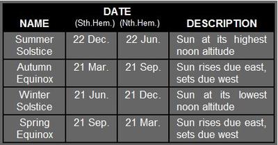 |
There are four important dates to remember when considering sun position |
Look at specific times of day:
Morning: You may want to capture sun’s energy to warm up spaces when the sun is low in sky. But you’ll also need to protect against glare.
Noon: Sun is the strongest and highest in the sky. You may want to avoid the hot midday sun to reduce cooling loads in some areas. But you may want to capture the sun in other cases for passive solar heating or energy generation.
Note that sometimes noon is not the highest altitude angle. This is because of the difference between “solar time” (determined by position of sun) and “local time” (determined by time zone).
Afternoon: You may want to prevent overheating and glare
Occupancy hours: You may be particularly concerned about the times when the building is most heavily occupied.
Solar Time vs. Local Time
In most locations, there will normally be a difference between solar and local time. Solar time is determined by the position of the sun. At noon it is at its highest altitude, with sunrise and sunset occurring at symmetrical times either side of noon.
Local (or clock) time is determined by the local time zone and is taken at a reference longitude. For example, the local time zone for Perth is taken at a longitude of 120° (in the middle of Western Australia). However, the longitude of Perth is 116°.
For each degree of difference in longitude between the actual and reference, there is a 4-minute time difference. Thus, to convert solar time to local time, use the following formula:
Tlocal = Tsolar + ((Longitude - Longituderef) * 4)
If you notice in some of your analyses that the sun is not the highest at noon on your building site, this is the reason.
You’ll usually want to do analysis with respect to local times because that’s the time that all other members of the design team will be referencing for things like operation schedules.
Visualizing the Sun Path
There are several ways of visualizing the sun's path.
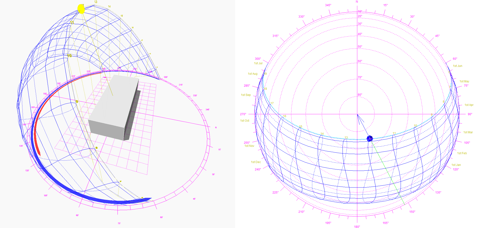
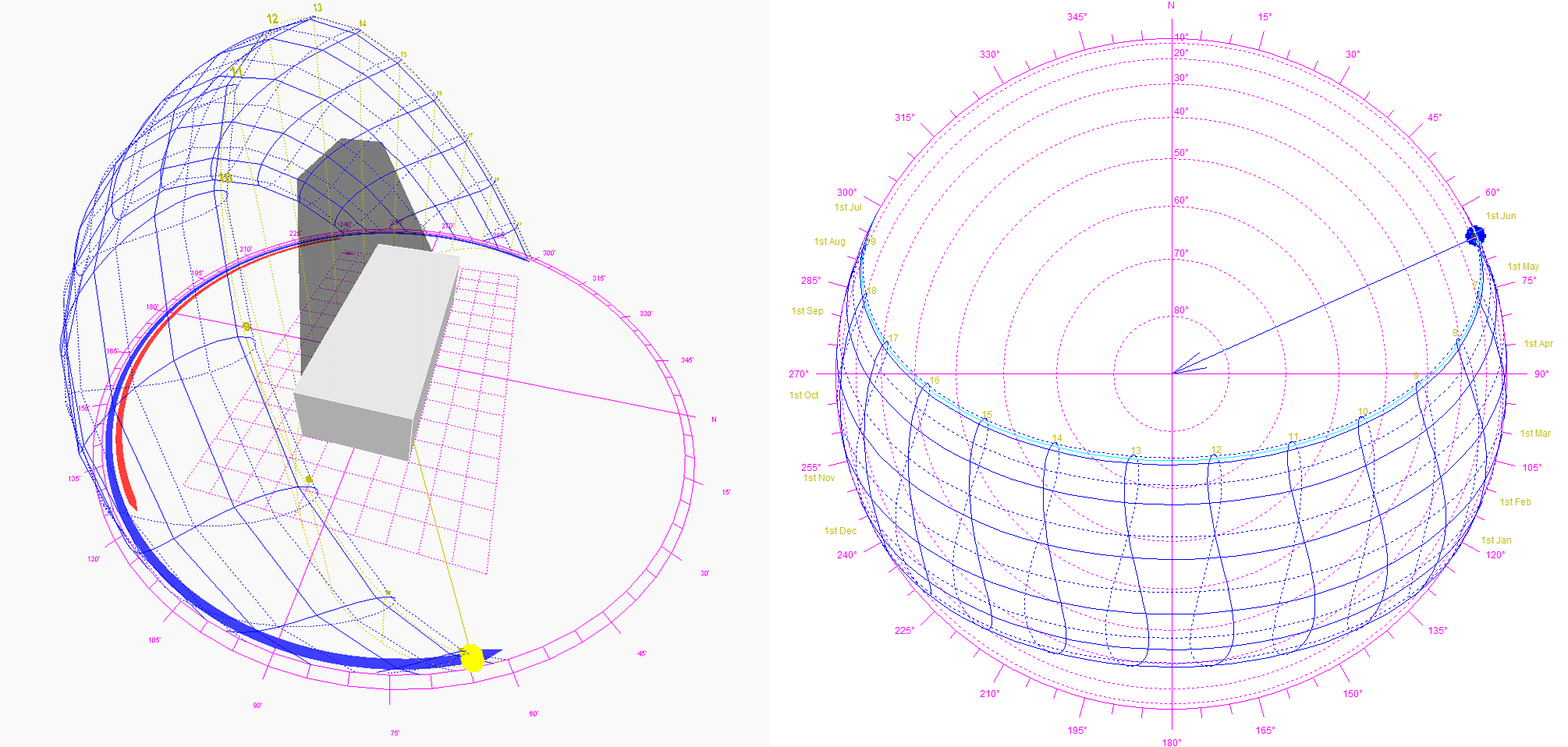
Stereographic sun path diagrams are used to read the solar azimuth and altitude throughout the day and year for a given position on the earth. They can be likened to a photograph of the sky, taken looking straight up towards the zenith, with a 180° fish-eye lens. The paths of the sun at different times of the year can then be projected onto this flattened hemisphere for any location on Earth.
|
(Click on the image to view animation) |
Summer Sunpath On the left is a 3D visualization of the stereographic diagram on the right, showing the movement of the sun throughout the day on June 21st. (summer solstice) |
|
(Click on the image to view animation) |
Winter Sunpath On the left is a 3D visualization of the stereographic diagram on the right, showing the movement of the sun throughout the day on December 21st (winter solstice) |
|
(Click on the image to view animation) |
The Sun at Noon On the left is a 3D visualization of the stereographic diagram on the right, showing the position of the sun throughout the year at the fixed hour of 12pm. |